На информационном ресурсе применяются рекомендательные технологии (информационные технологии предоставления информации на основе сбора, систематизации и анализа сведений, относящихся к предпочтениям пользователей сети "Интернет", находящихся на территории Российской Федерации)

#Satellite imagery

Satellite images show the devastating floods in the Midwest

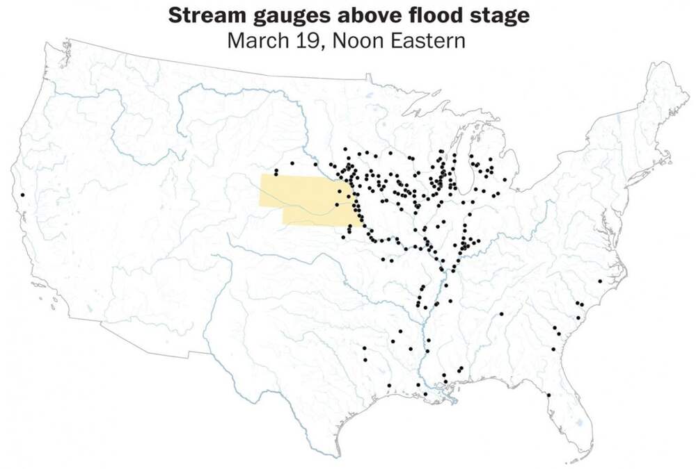
Author: Bonnie Berkowitz / Source: Washington Post Much of the Midwest is dealing with catastrophic flooding this week along the Missouri and Mississippi river basins, the result of a hurricane-like winter storm called a “bomb cyclone” that dropped huge amounts of rain, melted existing snow and
...Далее

Striking Satellite Images of Cities on the Brink

Author: Jessica Leigh Hester / Source: Atlas Obscura From the window of her office in New Haven, Connecticut, Karen Seto sees a sea of green. A professor of geography and urbanization science at the Yale School of Forestry and Environmental Studies, Seto can observe in that scene seemingly
...Далее

AI Can See America’s Wealth Inequality From Space

Author: Teodora Zareva / Source: Big Think What does wealth look like… from space? This is the question researchers from Carnegie Mellon University wanted to answer when they built Penny. Penny is an AI built on machine learning using neural networks. Through an interactive website Penny lets you
...Далее

Before and After Photos Show California’s Super Bloom From Space

Source: mentalfloss.com Due to a little extra rain, California’s “super bloom” has been especially vibrant this year. Places like Anza-Borrego Desert State Park and Los Padres National Forest have seen a huge explosion of colorful wildflowers this spring compared to years past. The effect is even
...Далее
наверх