Author: Jessica Leigh Hester / Source: Atlas Obscura
From the window of her office in New Haven, Connecticut, Karen Seto sees a sea of green. A professor of geography and urbanization science at the Yale School of Forestry and Environmental Studies, Seto can observe in that scene seemingly countless different shades, shapes of leaves, and natural textures.
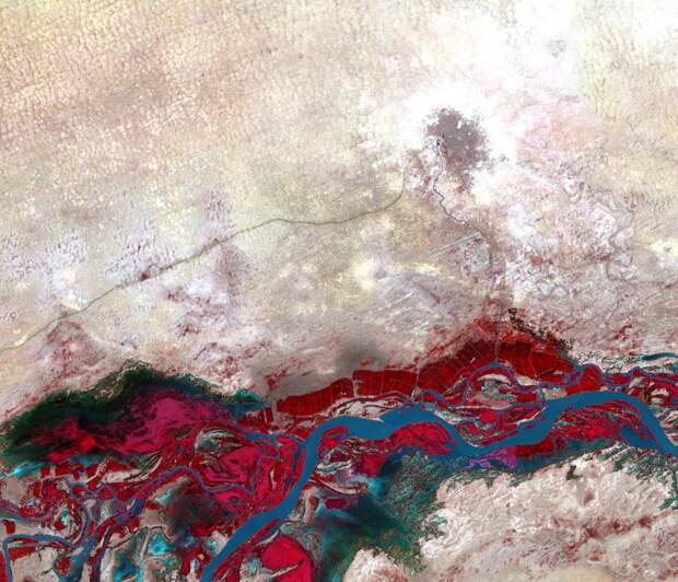
It’s familiar and pretty, but there’s only so much that our eyes can wring from a view like that. There’s a lot that we can’t see.If Seto could see in the near-infrared portion of the electromagnetic spectrum—outside of the range of human vision—a glance would reveal a wealth of other information. She could ascertain which leaves are overheated, or parched. In the adjacent buildings, she could peer beyond brick, glass, or steel, to the materials that comprise them. And if she could take this all in from space, she could see how her view fits in among the university’s Gothic roofs, sports fields, and criss-crossing walking paths.
But we can see like that, with the right technology. “Just as dogs can hear sounds inaudible to humans, sensors aboard satellites are able to ‘see’ what our eyes cannot,” write Seto and her coauthor Meredith Reba, a research associate, in their new book, City Unseen: New Visions of an Urban Planet. Seto and Reba dove into a trove of largely open-access satellite images of cities, then used image processing tools to adjust them, and highlight hidden dynamics or patterns that emerge over time. They can show the way heat bakes different parts of an urban area, how much sediment is building up in stagnant water, or how a landscape sprouts back to life in…
The post Striking Satellite Images of Cities on the Brink appeared first on FeedBox.