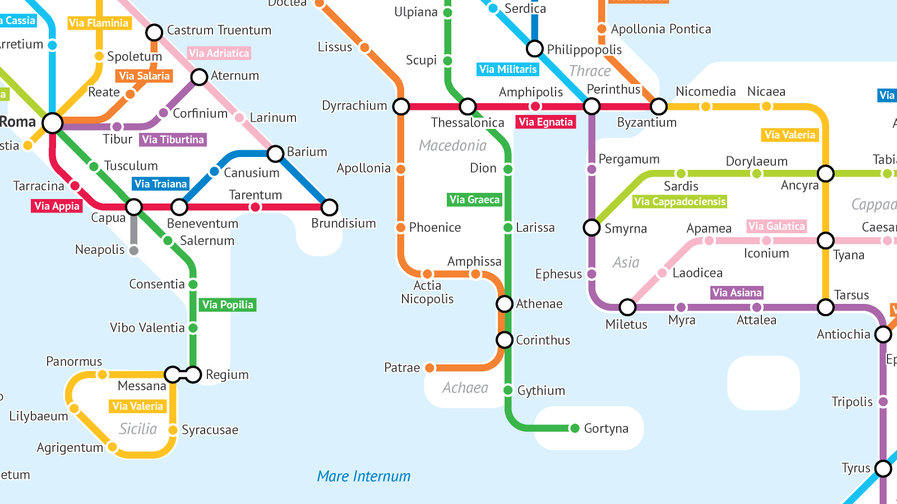
The Roman Empire would not have been possible without its roads. They connected Rome with the furthest corners of its dominion, from the Scottish border to the Arabian sands. Roads were the veins through which flowed the information, goods and soldiers that kept the empire healthy and strong.
But Romans were better road-builders than they were map-makers. No contemporary chart of the road network survives; the closest thing is the 13th-century Tabula Peutingeriana, a 1-by-22-foot copy of a now-lost, but certainly equally unwieldy original. Strangely, it takes a decidedly 20th-century cartographic motif to bring the importance of Rome’s roads truly into focus.
This map is modelled after the iconic London Underground diagram first produced by Harry Beck in 1931. Borrowing from the rectilinear design of electric circuits, Beck sacrificed geographical accuracy to simplicity and legibility, evenly spacing stations on straight, colour-coded lines – and creating a design icon in the process, the oft-imitated Tube map (see also #603).
This map, designed by University of Chicago statistics major and admitted “geography and data nerd” Sasha Trubetskoy, is subject to the same Faustian/Beckian deal, surrendering accuracy for effect. But what an effect. Finally, the importance of Rome’s road network is visualised.
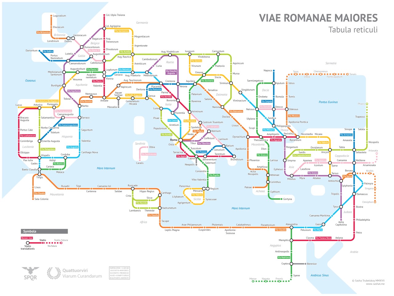
A note on that accuracy-versus-effect thing: the map shows the road system circa 125 AD, and only includes roads that did actually exist. However:
→ At its height, the Roman road network included more than 370 great roads, covering a total distance of more than 400,000 km (250,000 mi) of roads, over 80,500 km (50,000 mi) of which were stone-paved. Only a selection of main roads, and of major cities are shown here.
→ While many roads are named and indicated as they existed (e.g. Via Appia and Via Delapidata), some roads have been merged (e.g. the Via Latina,…
The post A Tube-style Map of Roman Roads appeared first on FeedBox.