Author: Carolyn Gramling / Source: Science News for Students
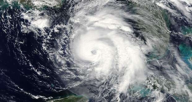
Call Hurricane Michael the October surprise. This fast-moving cyclone strengthened unusually quickly — in less than two days.
Then, it slammed into the Florida panhandle on October 10. The panhandle is a curving coastline surrounding the northeastern Gulf of Mexico. As Michael swiftly blew north into Georgia, it lost little of its oomph.Key to its damage, especially in Florida, were the ferocious winds in its eyewall. That’s the wall of super-strong winds that surround the calm heart at the center of a hurricane.
The storm made landfall with sustained winds of about 250 kilometers per hour (155 miles per hour). That speed falls just shy of a category 5 storm. Were it just 2 kph (2 mph) faster, it would have qualified as a Cat 5 cyclone. Michael also came in as the strongest storm ever to hit the region. That’s according to the National Hurricane Center, or NHC, in Miami, Fla.
Warm ocean waters fuel a hurricane. They do this by feeding it heat and moisture. The drier air over land, by contrast, helps to strip power from a storm. So hurricanes nearing the Florida panhandle tend to weaken as they pull in the drier air from land.
But not with Michael. The…
The post Hurricane Michael slams into Florida, then speeds north appeared first on FeedBox.