На информационном ресурсе применяются рекомендательные технологии (информационные технологии предоставления информации на основе сбора, систематизации и анализа сведений, относящихся к предпочтениям пользователей сети "Интернет", находящихся на территории Российской Федерации)

Feedbox

12 подписчиков

New mapping shows just how much fishing impacts the world’s seas

Author: Carolyn Gramling / Source: Science News

fishing map
VESSEL VIEWER By tracking the activity of more than 70,000 fishing vessels, researchers made this 2016 map of total global fishing activity. Dots represent the average hours of activity within an area spanning 10,000 square kilometers.

Fishing has left a hefty footprint on Earth.

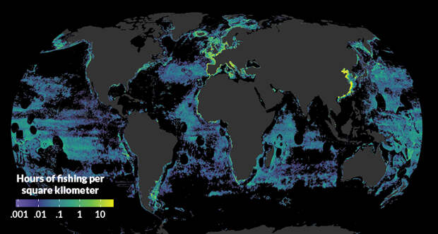
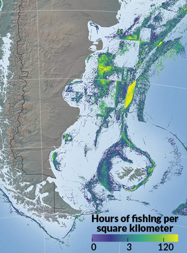
Oceans cover more than two-thirds of the planet’s surface, and industrial fishing occurred across 55 percent of that ocean area in 2016, researchers report in the Feb. 23 Science. In comparison, only 34 percent of Earth’s land area is used for agriculture or grazing.

Previous efforts to quantify global fishing have relied on a hodgepodge of scant data culled from electronic monitoring systems on some vessels, logbooks and onboard observers. But over the last 15 years, most commercial-scale ships have been outfitted with automatic identification system (AIS) transceivers, a tracking system meant to help ships avoid collisions.

Fish are drawn to upwelling zones, where prevailing winds transport away surface water and allow nutrient-rich deep water to rise toward the…

Click here to read more

The post New mapping shows just how much fishing impacts the world’s seas appeared first on FeedBox.

Ссылка на первоисточник
Рекомендуем
Популярное
наверх