Author: Bruce Bower / Source: Science News
A laser-shooting eye in the sky has revealed the previously unappreciated size and complexity of ancient Maya civilization, both before and during its presumed heyday, scientists say.
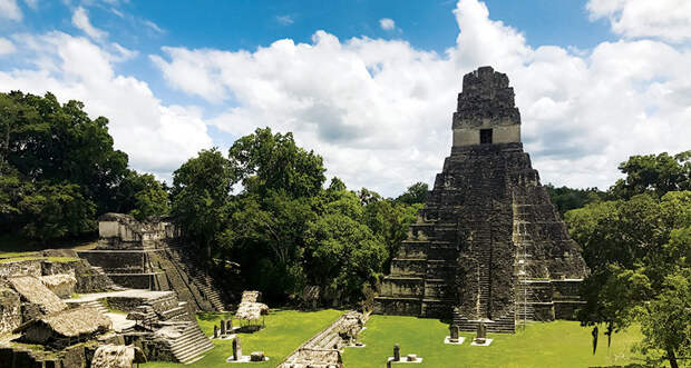
Maya people in what’s now northern Guatemala built surprisingly extensive defensive structures and roads as part of political systems featuring interconnected cities, starting at least several hundred years before the rise of Classic Maya society, an international team reports in the Sept. 28 Science. Classic Maya sites date to between around 250 and 900.
Aerial laser maps of northern Guatemala obtained in 2016 and map-guided ground surveys and excavations in 2017 compel a reevaluation of traditional assumptions about the ancient Maya, the team concludes. A long-standing idea that Classic Maya civilization, which covered parts of southern Mexico and much of Central America, once contained relatively small city-states ruled by warring kings has drawn increasing skepticism over the last decade (SN Online: 4/17/18). Laser technology shot down that scenario by gazing through forests and vegetation at 10 Maya sites — as well as in two areas with signs of Maya-era activity but no named sites — dating from a couple hundred years before the start of the Classic period to near its end. “Every Maya city was bigger and more populated than we previously thought,” says archaeologist Francisco Estrada-Belli of Tulane University in New Orleans. Estrada-Belli led the investigation along with archaeologists Marcello Canuto, also at Tulane, and Thomas Garrison of Ithaca College in New York.
A small plane carrying light detection and ranging equipment, or lidar, emitted laser pulses that…
The post Laser mapping shows the surprising complexity of the Maya civilization appeared first on FeedBox.