Author: Oliver Milman / Source: Atlas Obscura
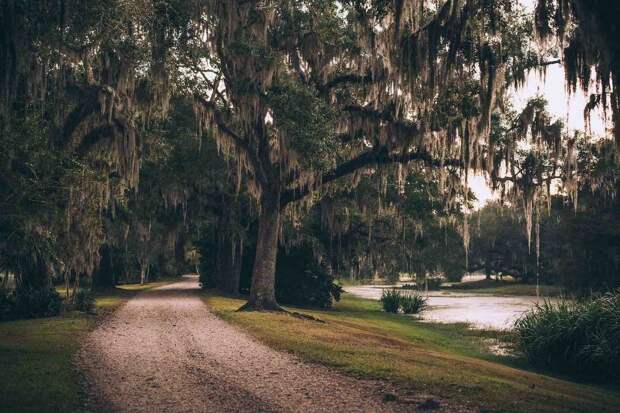
Avery Island, a dome of salt fringed by marshes where Tabasco sauce has been made for the past 150 years, has been an outpost of stubborn consistency near the Louisiana coast. But the state is losing land to the seas at such a gallop that even its seemingly impregnable landmarks are now threatened.
The home of Tabasco, the now ubiquitous but uniquely branded condiment controlled by the same family since Edmund McIlhenny first stumbled across a pepper plant growing by a chicken coop on Avery Island, is under threat. An unimaginable plight just a few years ago, the advancing tides are menacing its perimeter.
“It does worry us, and we are working hard to minimize the land loss,” said Tony Simmons, the seventh consecutive McIlhenny family member to lead the company. “We want to protect the marsh because the marsh protects us.”
Simmons allows a silent pause as he mulls a situation where Tabasco is forced off the island. “We don’t think it will come to that, but we are working to do everything we can to make sure it won’t happen to us,” he said. “I mean, we could make Tabasco somewhere else. But this is more than a business: This is our home.”
A geologic oddity, Avery Island rises to 163 feet above sea level, making it a towering giant amid the supine flatness of Louisiana’s coast. The 2,200-acre island—more accurately a hill of buried salt surrounded by bayou and marsh a couple of miles inland from Vermilion Bay, an inlet of the Gulf of Mexico—has long provided a sturdy home to Tabasco but now faces the danger of being marooned.
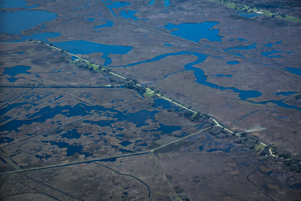
The Avery Island marshes are retreating by around 30 feet a year as salt water seeps in, ushered in by canals dug by the oil and gas industry and the level of the land itself, which is gradually sinking by around a third of an inch a year. The salty brine kills off vegetation, loosens soils, and accelerates erosion.
Fierce storms clatter into what’s left of the marsh, which is also being slowly drowned by a warming ocean that’s rising faster than almost anywhere else in the world. A further sea level increase of two feet, almost certain given the warming that’s already occurred, will leave only the lofty core of Avery Island dry, according to the National Oceanic and Atmospheric Administration.
“The marsh stands between us and Vermilion Bay, and we don’t want to be right on the bay,” Simmons said. “We have to be very aggressive about dealing with the land loss. We almost can’t work fast enough.”

The threat posed to Tabasco is replicated along much of Louisiana’s coast, where a football field of land is lost every 100 minutes. Around 2,000 square miles of land, roughly the size of Delaware, has vanished from the state since the 1930s due to a cocktail of maladies and self-inflicted wounds, stemming from the overdevelopment of the Mississippi River and an unquestioning embrace of extractive drilling, topped off by the wrenching global consequences of climate change.
The U.S. has already been stripped of half of its wetlands since Europeans arrived and Louisiana, which accounts for a bulk of these losses, is on course to lose all of its wetland within two more centuries, according to the U.S. Geological Survey.
A master plan set out by the state government last year forecast a further 2,250 square miles of Louisiana could be lost over the next 50 years, forcing 27,000 buildings to be flood-proofed, elevated, or bought out.
The plan sets out billions of dollars in work building protective seawalls, restoring marshland and increasing the amount of nourishing sediment carried to wetlands by the Mississippi, which hasn’t been left to…
The post How Climate Change Could Swallow Louisiana’s Tabasco Island appeared first on FeedBox.