Author: Frank Jacobs / Source: Big Think
- Using satellite images and artificial intelligence, OneSoil wants to make ‘precision farming’ available to the world.
- The start-up from Belarus has already processed the U.S. and Europe, and aims for global coverage by 2020.
- The map is practical, and more — browse ‘Random Beautiful Fields’ at the touch of a button.
Where farming meets art
Image: OneSoil
Circular crop farming near Sublette, in southwestern Kansas.
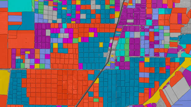
This is where precision farming meets abstract art. OneSoil, an agritech start-up from Belarus, has just launched an interactive digital map of crop data for more than 57 million fields across the U.S. and Europe.
The map provides detailed information on various crop types in 43 countries collected over the past three years, allowing users to see how fields have changed from 2016 to 2018.
The OneSoil map makes local and global trends in crop production available to everyone with a stake in farming. In so doing, it helps predict market performance of these crops, and aids decision-making by farmers and traders.
Random fields
Image: OneSoil
Atypically square for Europe, these fields are in Flevoland, the Dutch province reclaimed from the sea.
But the map is more than just practical. It boasts a ‘Random Beautiful Fields‘ button that could keep you occupied for the next few hours. As the company’s website says, “the map is a great interactive tool for students and researchers. And last but not least, it is simply fun.”
The data for the OneSoil map comes from open-source satellite imagery released by ESA, the European Space Agency.
By a combination of computerized visual analysis and machine-learning algorithms, OneSoil has been able to distinguish between 19 different crops with 92% accuracy. The map provides info on hectarage, crop and…The post ‘Precision farming’ appeared first on FeedBox.