Author: Sarah Laskow / Source: Atlas Obscura
Late in the 16th century, mapmakers in Spanish Empire, working on continents across the ocean from Europe, didn’t have access to the age’s best technology.
Though the first printed maps in Europe had been made a century before, map printing had yet to make it to the Spanish American colonies. When they needed to make maps, they still made them by hand.This was at the height of Spain’s global influence, what’s sometimes called the Siglo de Oro, the country’s golden age. To better understand and control the vast areas the Spanish Crown had claimed around the world, King Philip II ordered a survey. Each local administrator had to send back a map detailing the land he oversaw.
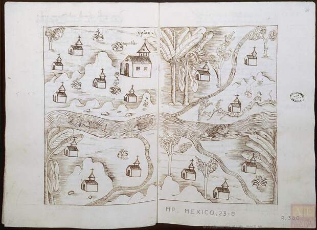
The dozens of maps were sent back to Spain. But among these, Manuel Morato-Moreno, of the University of Seville’s Department of Graphic Engineering, discovered a small set unlike the rest. Drawing from ways of mapmaking old and new, influences from Europe and from Central America, these maps adopted and imitated techniques specific to printed maps—but were all hand-drawn.
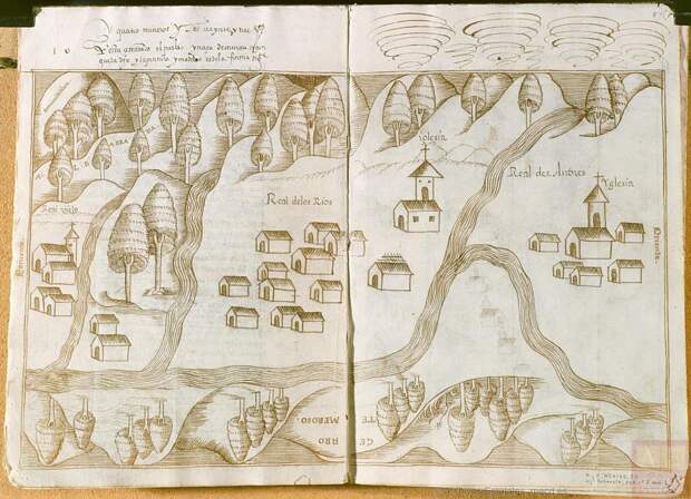
It’s as if a magazine designer in the 1990s tried to imitate the style of a early website. (And surely that must have happened? Clue us in if you know the perfect example.) Only, these maps had other unique characteristics, too, drawn from the place they were made. They mixed the conventions of the time’s European cartography with indigenous influences and earlier European map and illustration tropes.
These maps—seven in all, made in 1579 and 1580—“present a peculiar style,” says Morato-Moreno, with a “dose of ingenuity” unparalleled in the whole, extensive corpus of maps made of Spanish America in the 16th century.
Morato-Moreno describes the maps in a paper for the journal Cartographica. Two describe the…
The post In Spanish America, Cartographers Hand-Drew Maps Inspired by Printed Ones appeared first on FeedBox.