Source: Futility Closet
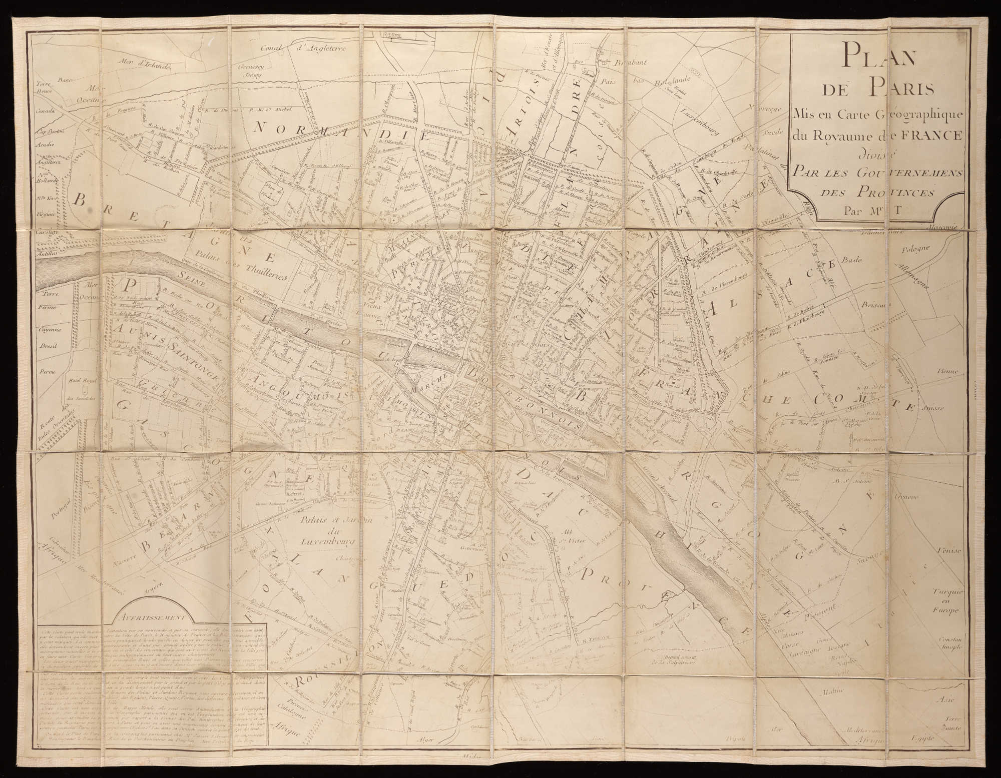
In 1801, distressed at the “incoherence” and “bizarreness” of Paris street names, J.B. Pujoulx proposed turning the city into a stylized map of France in which the streets were named after towns and localities, with the size of each town reflected in the size of the street. Rivers and mountains would be represented by especially long streets that crossed several districts, “to provide an ensemble such that a traveller could acquire geographic knowledge of France within Paris, and reciprocally of Paris within France.
”How…
The post City/State appeared first on FeedBox.