Author: Jennifer Leman / Source: Science News
By mapping how downpours cause Earth’s crust to sag and swell, scientists may one day better forecast floods.
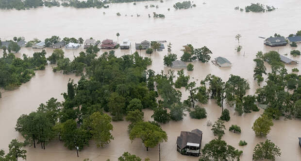
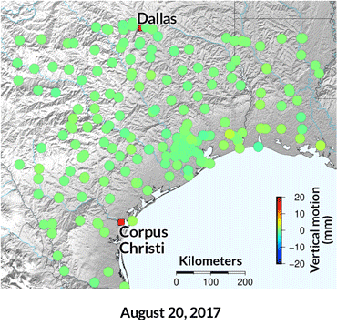
When Hurricane Harvey struck the southern United States in August 2017, it crushed rainfall records and doused the region with roughly 95 cubic kilometers of water, leaving cities like Houston inundated. Using daily elevation data from 219 GPS stations along Harvey’s path, scientists traced the rise and fall of Earth’s surface. “The idea was to try to provide a new approach to tracking storm water,” says Christopher Milliner, a geodesist at NASA’s Jet Propulsion Laboratory in Pasadena, Calif.
The weight of the water caused some parts of the Gulf Coast to sink by as much as 21 millimeters and then rebound, depending on how quickly the water flowed away or evaporated, Milliner and his colleagues report online September 19 in Science Advances. Such tracking could aid future predictions for how floodwaters might move and where they might pool.
GPS stations (colored dots) recorded Earth’s crust sinking up to 21 millimeters after Hurricane Harvey made landfall in Houston on August 25, 2017, and zigzagged over the coastline (red line).
Meteorological forecasts already reliably track where large amounts of rain fall, helping communities prepare for potential flooding. But these forecasts can’t always predict where that water will…
The post Tracking how rainfall morphs Earth’s surface could help forecast flooding appeared first on FeedBox.